
Chapter Leonardo negli studi ottocenteschi sulla cartografia delle Alpi
About this book
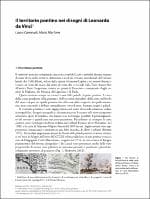
Leonardo’s manuscripts contain many quotes of ‘his’ Western Alps, well-known mountains sketched, with lakes, rivers and towns, creating outstanding territorial readings. In the 19th century, he became a turning point between medieval representation techniques and the great cartographic reform of the 16th century. Leonardo’s approach to territorial drawing, his evolutionary theories on the history of the Earth, his measuring and survey instruments, his calculation of mountains altitudes can be compared to subsequent maps confirming, , with ideal overlaps, the crystal clear anticipations of the ‘Grande di Vinci’.
Format
Digital book
Language
Not available
Publisher
Not available
SKU
Not available
Stack books. Chase the perfect drop.
Time your move, land a perfect stack, and climb the high-score shelf.
Play Book Stack
Sponsored
Tanow helps you turn reading inspiration into action.
Save quotes, organize priorities, and track progress in a cleaner daily workflow built for focus.
Quote capture
Store meaningful lines and revisit them faster.
Daily planning
Keep tasks visible and simple throughout the day.
Habit progress
Build consistency with lightweight progress tracking.
Get Tanow on Google Play4.8/5 rating and 10,000+ downloads
TanowFocus Mode
Small actions repeated every day create visible progress.
Reading goal80%
Habit streak60%
Product details
Leonardo’s manuscripts contain many quotes of ‘his’ Western Alps, well-known mountains sketched, with lakes, rivers and towns, creating outstanding territorial readings. In the 19th century, he became a turning point between medieval representation techniques and the great cartographic reform of the 16th century. Leonardo’s approach to territorial drawing, his evolutionary theories on the history of the Earth, his measuring and survey instruments, his calculation of mountains altitudes can be compared to subsequent maps confirming, , with ideal overlaps, the crystal clear anticipations of the ‘Grande di Vinci’.